
- Start >
- Groundwater >
- Waterlevel of upper layer >
- Untere Donau >
- Isarvorland P5 >
- Current data

Current data Isarvorland P5
Groundwater levels of the last 12 months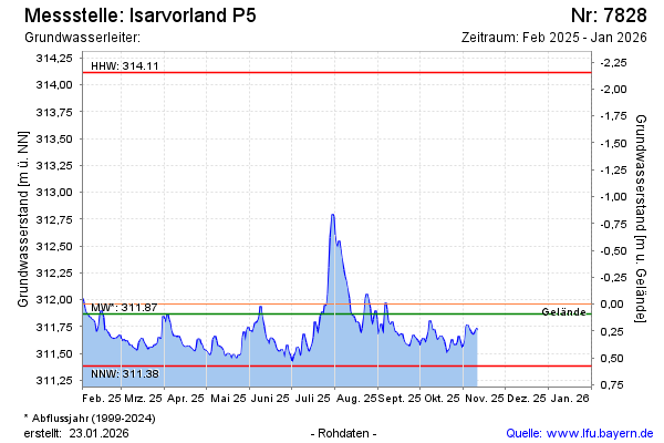
note
GW Messstelle im SN Isarvorland
Groundwater level [m above sealevel]: 311.96
Distance to surface [m]: 0.00
Last value from 17.01.2025 10:25
Ground level [m above sealevel]: 311.96
| Date | Groundwater level [m above sealevel] |
|---|---|
| 31.12.2024 | 311.78 |
| 30.12.2024 | 311.80 |
| 29.12.2024 | 311.80 |
| 28.12.2024 | 311.79 |
| 27.12.2024 | 311.81 |
| 26.12.2024 | 311.88 |
| 25.12.2024 | 311.96 |
| 24.12.2024 | 312.03 |
© Bayerisches Landesamt für Umwelt 2025