
- Start >
- Groundwater >
- Waterlevel of upper layer >
- Untere Donau >
- OTTMARING_OP14 >
- Chart of total period

Chart of total period OTTMARING_OP14
Groundwater levels of the total period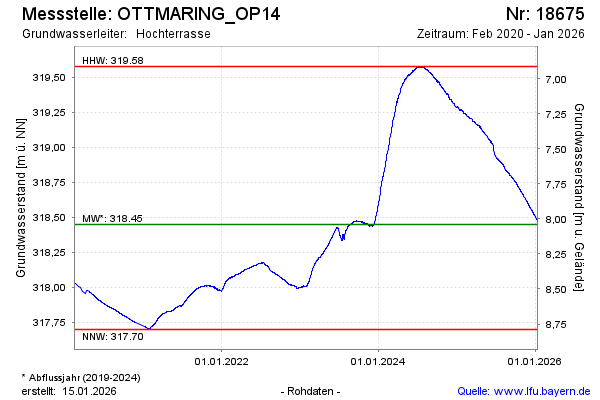
Groundwater level [m above sealevel]: 319.20
Distance to surface [m]: 7.29
Last value from 13.03.2025 08:00
Ground level [m above sealevel]: 326.49
| Date | Groundwater level [m above sealevel] |
|---|---|
| 13.03.2025 | 319.20 |
| 12.03.2025 | 319.20 |
| 11.03.2025 | 319.20 |
| 10.03.2025 | 319.20 |
| 09.03.2025 | 319.21 |
| 08.03.2025 | 319.20 |
| 07.03.2025 | 319.20 |
| 06.03.2025 | 319.20 |
© Bayerisches Landesamt für Umwelt 2025