
- Start >
- Groundwater >
- Waterlevel of upper layer >
- Untere Donau >
- TABECKENDORF K 8A >
- Chart of total period

Chart of total period TABECKENDORF K 8A
Groundwater levels of the total period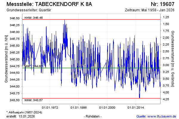
note
GW Messstelle im Verdichtungsnetz
Groundwater level [m above sealevel]: 344.86
Distance to surface [m]: 2.93
Last value from 15.02.2025 08:00
Ground level [m above sealevel]: 347.79
| Date | Groundwater level [m above sealevel] |
|---|---|
| 15.02.2025 | 344.86 |
| 14.02.2025 | 344.87 |
| 13.02.2025 | 344.89 |
| 12.02.2025 | 344.88 |
| 11.02.2025 | 344.87 |
| 10.02.2025 | 344.88 |
| 09.02.2025 | 344.89 |
| 08.02.2025 | 344.91 |
© Bayerisches Landesamt für Umwelt 2025