
- Start >
- Groundwater >
- Waterlevel of upper layer >
- Untere Donau >
- UNTERE ISAR SP 57 >
- Chart of total period

Chart of total period UNTERE ISAR SP 57
Groundwater levels of the total period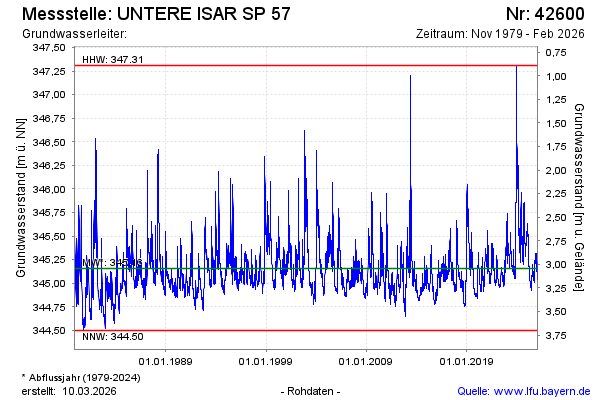
Groundwater level [m above sealevel]: 345.52
Distance to surface [m]: 2.68
Last value from 10.02.2025 10:15
Ground level [m above sealevel]: 348.20
| Date | Groundwater level [m above sealevel] |
|---|---|
| 31.12.2024 | 345.44 |
| 30.12.2024 | 345.46 |
| 29.12.2024 | 345.47 |
| 28.12.2024 | 345.47 |
| 27.12.2024 | 345.48 |
| 26.12.2024 | 345.49 |
| 25.12.2024 | 345.50 |
| 24.12.2024 | 345.51 |
© Bayerisches Landesamt für Umwelt 2025