
- Start >
- Groundwater >
- Waterlevel of upper layer >
- Untere Donau >
- UNTERE ISAR SP 61 >
- Current data

Current data UNTERE ISAR SP 61
Groundwater levels of the last 12 months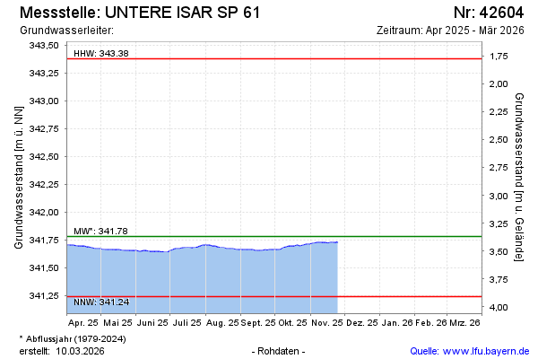
Groundwater level [m above sealevel]: 341.86
Distance to surface [m]: 3.29
Last value from 10.02.2025 10:55
Ground level [m above sealevel]: 345.15
| Date | Groundwater level [m above sealevel] |
|---|---|
| 31.12.2024 | 341.89 |
| 30.12.2024 | 341.90 |
| 29.12.2024 | 341.90 |
| 28.12.2024 | 341.91 |
| 27.12.2024 | 341.91 |
| 26.12.2024 | 341.91 |
| 25.12.2024 | 341.91 |
| 24.12.2024 | 341.91 |
© Bayerisches Landesamt für Umwelt 2025