
- Start >
- Groundwater >
- Waterlevel of upper layer >
- Regnitz >
- Ansbach HW GWM 5 >
- Chart of total period

Chart of total period Ansbach HW GWM 5
Groundwater levels of the total period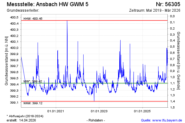
Groundwater level [m above sealevel]: 399.41
Distance to surface [m]: 1.07
Last value from 11.02.2025 11:57
Ground level [m above sealevel]: 400.48
| Date | Groundwater level [m above sealevel] |
|---|---|
| 11.02.2025 | 399.41 |
| 10.02.2025 | 399.40 |
| 09.02.2025 | 399.40 |
| 08.02.2025 | 399.42 |
| 07.02.2025 | 399.43 |
| 06.02.2025 | 399.40 |
| 05.02.2025 | 399.40 |
| 04.02.2025 | 399.42 |
© Bayerisches Landesamt für Umwelt 2025