
- Start >
- Groundwater >
- Waterlevel of upper layer >
- Regnitz >
- Ansbach HW GWM 6 >
- Chart of total period

Chart of total period Ansbach HW GWM 6
Groundwater levels of the total period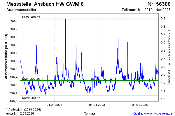
Groundwater level [m above sealevel]: 399.30
Distance to surface [m]: 0.99
Last value from 16.04.2025 07:45
Ground level [m above sealevel]: 400.29
Date | Groundwater level [m above sealevel] |
|---|---|
| 16.04.2025 | 399.29 |
| 15.04.2025 | 399.31 |
| 14.04.2025 | 399.30 |
| 13.04.2025 | 399.30 |
| 12.04.2025 | 399.31 |
| 11.04.2025 | 399.29 |
| 10.04.2025 | 399.28 |
| 09.04.2025 | 399.29 |
© Bayerisches Landesamt für Umwelt 2025