
- Start >
- Groundwater >
- Waterlevel of upper layer >
- Regnitz >
- Burgthann K 6 >
- Current data

Current data Burgthann K 6
Groundwater levels of the last 12 months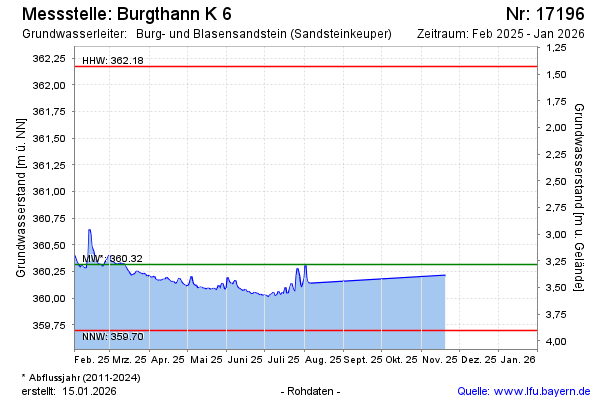
Groundwater level [m above sealevel]: 360.35
Distance to surface [m]: 3.25
Last value from 16.01.2025 11:15
Ground level [m above sealevel]: 363.60
| Date | Groundwater level [m above sealevel] |
|---|---|
| 16.01.2025 | 360.35 |
| 15.01.2025 | 360.37 |
| 14.01.2025 | 360.39 |
| 13.01.2025 | 360.40 |
| 12.01.2025 | 360.46 |
| 11.01.2025 | 360.54 |
| 10.01.2025 | 360.69 |
| 09.01.2025 | 360.70 |
© Bayerisches Landesamt für Umwelt 2025