
- Start >
- Groundwater >
- Waterlevel of upper layer >
- Regnitz >
- SCHIRRADORF BT-W1 >
- Current data

Current data SCHIRRADORF BT-W1
Groundwater levels of the last 12 months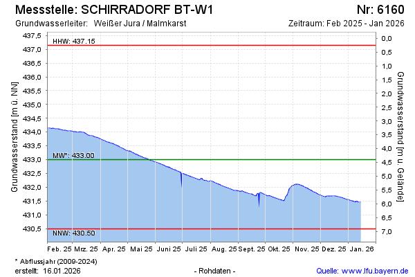
Groundwater level [m above sealevel]: 434.08
Distance to surface [m]: 3.32
Last value from 16.02.2025 10:00
Ground level [m above sealevel]: 437.40
| Date | Groundwater level [m above sealevel] |
|---|---|
| 16.02.2025 | 434.09 |
| 15.02.2025 | 434.09 |
| 14.02.2025 | 434.10 |
| 13.02.2025 | 434.11 |
| 12.02.2025 | 434.11 |
| 11.02.2025 | 434.11 |
| 10.02.2025 | 434.11 |
| 09.02.2025 | 434.12 |
© Bayerisches Landesamt für Umwelt 2025