
- Start >
- Rivers >
- Discharge >
- Untere Donau >
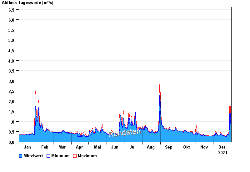
- Freising >
- Chart of year

Chart of year Freising / Schleifermoosach
Discharge from 01.01.2021 to 31.12.2021
 Für diesen Pegel sind keine Jährlichkeiten hinterlegt.
| Date | Mean value [m³/s] | Maximum [m³/s] | Minimum [m³/s] |
|---|---|---|---|
| 31.12.2021 | 1.03 | 1.26 | 0.828 |
| 30.12.2021 | 1.61 | 1.94 | 1.26 |
| 29.12.2021 | 1.44 | 1.79 | 0.933 |
| 28.12.2021 | 0.472 | 0.933 | 0.368 |
| 27.12.2021 | 0.378 | 0.392 | 0.365 |
| 26.12.2021 | 0.4 | 0.409 | 0.389 |
| 25.12.2021 | 0.381 | 0.403 | 0.348 |
© Bayerisches Landesamt für Umwelt 2024