
- Start >
- Rivers >
- Waterlevel >
- Bayern >
- Appolding >
- Chart of year

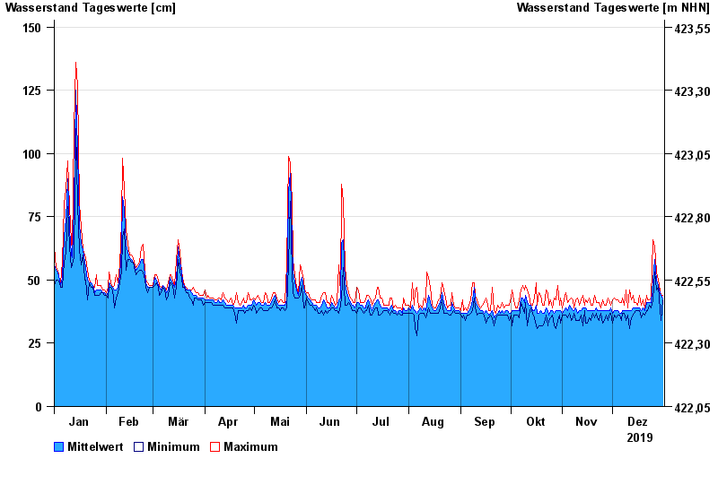
Chart of year Appolding / Strogen
Waterlevel from 01.01.2019 to 31.12.2019
- 03.06.2013 Wasserstand: 271 cm
- 02.08.1991 Wasserstand: 256 cm
- 15.02.1990 Wasserstand: 233 cm
- 14.04.1994 Wasserstand: 214 cm
- 18.06.1979 Wasserstand: 213 cm
| Date | Mean value [cm] | Maximum [cm] | Minimum [cm] |
|---|---|---|---|
| 31.12.2019 | 43 | 44 | 42 |
| 30.12.2019 | 44 | 44 | 34 |
| 29.12.2019 | 46 | 48 | 43 |
| 28.12.2019 | 48 | 50 | 47 |
| 27.12.2019 | 50 | 53 | 46 |
| 26.12.2019 | 58 | 63 | 53 |
| 25.12.2019 | 50 | 66 | 42 |
© Bayerisches Landesamt für Umwelt 2025