
- Start >
- Rivers >
- Waterlevel >
- Bayern >
- Astheim >
- Chart of year

Chart of year Astheim / Main
Waterlevel from 01.01.2023 to 31.12.2023
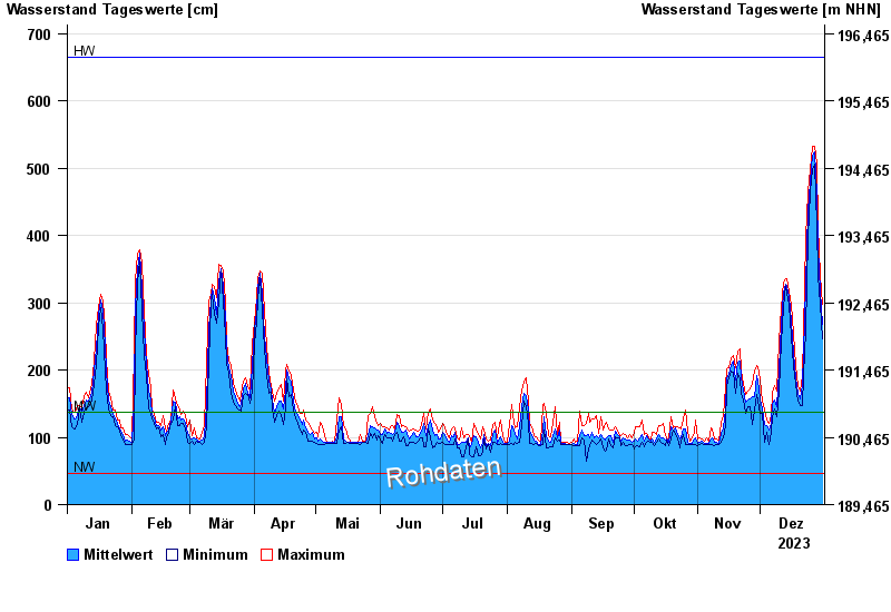
| Date | Mean value [cm] | Maximum [cm] | Minimum [cm] |
|---|---|---|---|
| 31.12.2023 | 269 | 298 | 246 |
| 30.12.2023 | 316 | 340 | 298 |
| 29.12.2023 | 381 | 415 | 340 |
| 28.12.2023 | 461 | 503 | 414 |
| 27.12.2023 | 521 | 530 | 503 |
| 26.12.2023 | 516 | 529 | 494 |
| 25.12.2023 | 476 | 494 | 462 |
© Bayerisches Landesamt für Umwelt 2025