
- Start >
- Rivers >
- Waterlevel >
- Bayern >
- Bad Aibling >
- Chart of year

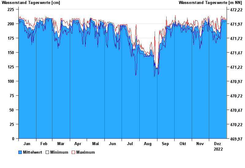
Chart of year Bad Aibling / Triftbach linker Mühlkanal
Waterlevel from 01.01.2022 to 31.12.2022
- 02.06.2013 Wasserstand: 332 cm
- 09.07.1954 Wasserstand: 313 cm
- 14.06.1959 Wasserstand: 291 cm
- 24.07.1966 Wasserstand: 283 cm
- 10.08.1970 Wasserstand: 280 cm
| Date | Mean value [cm] | Maximum [cm] | Minimum [cm] |
|---|---|---|---|
| 31.12.2022 | 206 | 208 | 204 |
| 30.12.2022 | 206 | 208 | 204 |
| 29.12.2022 | 206 | 208 | 203 |
| 28.12.2022 | 206 | 208 | 203 |
| 27.12.2022 | 207 | 211 | 203 |
| 26.12.2022 | 206 | 208 | 203 |
| 25.12.2022 | 206 | 208 | 204 |
© Bayerisches Landesamt für Umwelt 2025