
- Start >
- Rivers >
- Waterlevel >
- Bayern >
- Bad Tölz B472 >
- Chart of year

Chart of year Bad Tölz B472 / Isar
Waterlevel from 01.01.2017 to 31.12.2017
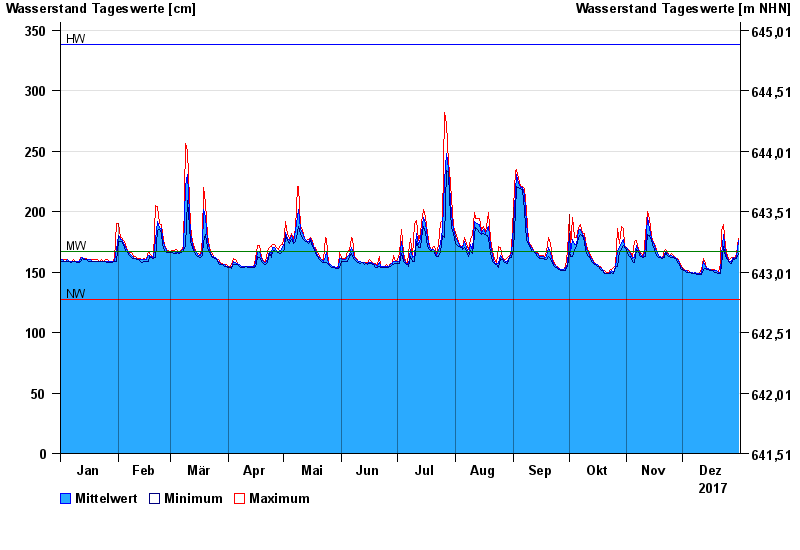
| Date | Mean value [cm] | Maximum [cm] | Minimum [cm] |
|---|---|---|---|
| 31.12.2017 | 176 | 178 | 165 |
| 30.12.2017 | 162 | 165 | 161 |
| 29.12.2017 | 161 | 161 | 160 |
| 28.12.2017 | 162 | 162 | 161 |
| 27.12.2017 | 159 | 162 | 157 |
| 26.12.2017 | 159 | 160 | 158 |
| 25.12.2017 | 161 | 163 | 160 |
© Bayerisches Landesamt für Umwelt 2025