
- Start >
- Rivers >
- Waterlevel >
- Bayern >
- Eberhardsreuth >
- Chart of year

Chart of year Eberhardsreuth / Mitternacher Ohe
Waterlevel from 01.01.2024 to 31.12.2024
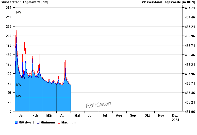
| Date | Mean value [cm] | Maximum [cm] | Minimum [cm] |
|---|---|---|---|
| 25.11.2024 | 74 | 75 | 74 |
| 24.11.2024 | 72 | 76 | 71 |
| 23.11.2024 | 73 | 74 | 72 |
| 22.11.2024 | 76 | 79 | 74 |
| 21.11.2024 | 84 | 92 | 79 |
| 20.11.2024 | 128 | 184 | 92 |
| 19.11.2024 | 96 | 129 | 73 |
© Bayerisches Landesamt für Umwelt 2024