
- Start >
- Rivers >
- Waterlevel >
- Bayern >
- Eichstätt >
- Chart of year

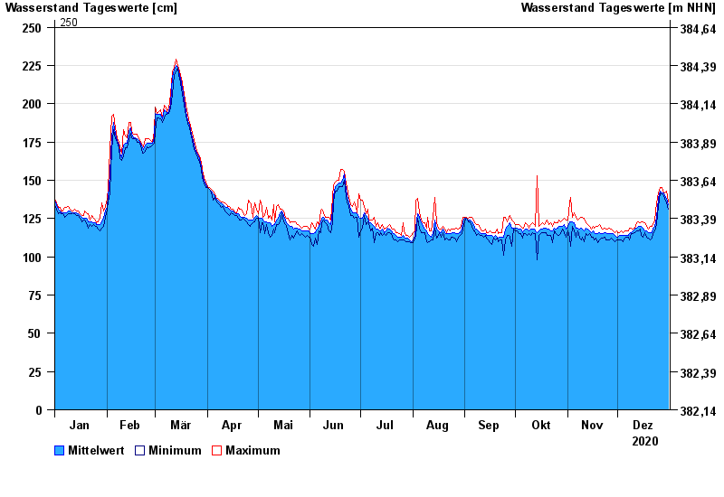
Chart of year Eichstätt / Altmühl
Waterlevel from 01.01.2020 to 31.12.2020
- 250 cm: Eichstätt: Ausuferung Campingplatz Kipfenberg.
- 270 cm: Dollnstein: Ausuferung Campingplatz unterhalb.
- 280 cm: Eichstätt: Beginn der Ausuferung unterhalb.
| Date | Mean value [cm] | Maximum [cm] | Minimum [cm] |
|---|---|---|---|
| 31.12.2020 | 134 | 136 | 131 |
| 30.12.2020 | 138 | 143 | 135 |
| 29.12.2020 | 140 | 142 | 138 |
| 28.12.2020 | 142 | 142 | 140 |
| 27.12.2020 | 142 | 145 | 141 |
| 26.12.2020 | 143 | 145 | 142 |
| 25.12.2020 | 138 | 142 | 133 |
© Bayerisches Landesamt für Umwelt 2025