
- Start >
- Rivers >
- Waterlevel >
- Bayern >
- Eichstätt >
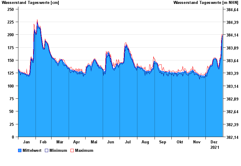
- Chart of year

Chart of year Eichstätt / Altmühl
Waterlevel from 01.01.2021 to 31.12.2021
- 19.03.1988 Wasserstand: 374 cm
- 23.12.1993 Wasserstand: 368 cm
- 16.04.1994 Wasserstand: 366 cm
- 05.03.1987 Wasserstand: 352 cm
- 14.01.2011 Wasserstand: 348 cm
| Date | Mean value [cm] | Maximum [cm] | Minimum [cm] |
|---|---|---|---|
| 31.12.2021 | 199 | 200 | 198 |
| 30.12.2021 | 192 | 200 | 187 |
| 29.12.2021 | 181 | 190 | 164 |
| 28.12.2021 | 156 | 164 | 152 |
| 27.12.2021 | 152 | 153 | 150 |
| 26.12.2021 | 151 | 154 | 142 |
| 25.12.2021 | 137 | 142 | 133 |
© Bayerisches Landesamt für Umwelt 2025