
- Start >
- Rivers >
- Waterlevel >
- Bayern >
- Eschelbach >
- Chart of year

Chart of year Eschelbach / Inn
Waterlevel from 28.07.2021 to 27.07.2022
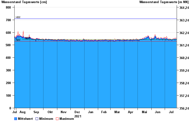
| Date | Mean value [cm] | Maximum [cm] | Minimum [cm] |
|---|---|---|---|
| 27.07.2022 | 546 | 551 | 541 |
| 26.07.2022 | 550 | 558 | 545 |
| 25.07.2022 | 545 | 550 | 539 |
| 24.07.2022 | 546 | 551 | 538 |
| 23.07.2022 | 549 | 555 | 540 |
| 22.07.2022 | 546 | 550 | 540 |
| 21.07.2022 | 549 | 552 | 544 |
© Bayerisches Landesamt für Umwelt 2024