
- Start >
- Rivers >
- Waterlevel >
- Bayern >
- Görisried >
- Chart of year

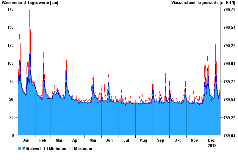
Chart of year Görisried / Waldbach
Waterlevel from 01.01.2018 to 31.12.2018
- 20.07.2007 Wasserstand: 327 cm
- 10.08.1970 Wasserstand: 289 cm
- 15.07.2002 Wasserstand: 271 cm
- 05.07.1969 Wasserstand: 245 cm
- 10.08.2002 Wasserstand: 237 cm
| Date | Mean value [cm] | Maximum [cm] | Minimum [cm] |
|---|---|---|---|
| 31.12.2018 | 58 | 64 | 53 |
| 30.12.2018 | 53 | 53 | 52 |
| 29.12.2018 | 53 | 54 | 52 |
| 28.12.2018 | 55 | 58 | 49 |
| 27.12.2018 | 58 | 61 | 56 |
| 26.12.2018 | 64 | 69 | 59 |
| 25.12.2018 | 77 | 90 | 66 |
© Bayerisches Landesamt für Umwelt 2025