
- Start >
- Rivers >
- Waterlevel >
- Bayern >
- Grafrath >
- Current values

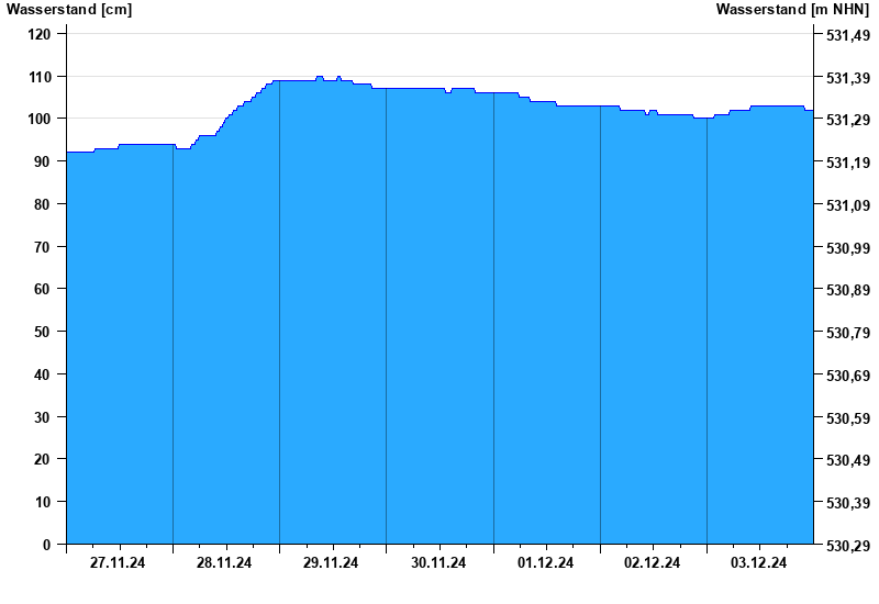
Current values Grafrath / Amper
Waterlevel from 27.11.2024 to 03.12.2024
- Hochwassergefahrenfläche HQ100 350 cm
| Date | Waterlevel [cm] |
|---|---|
| 03.12.2024 23:45 | 102 |
| 03.12.2024 23:30 | 102 |
| 03.12.2024 23:15 | 102 |
| 03.12.2024 23:00 | 102 |
| 03.12.2024 22:45 | 102 |
| 03.12.2024 22:30 | 102 |
| 03.12.2024 22:15 | 102 |
© Bayerisches Landesamt für Umwelt 2025