
- Start >
- Rivers >
- Waterlevel >
- Bayern >
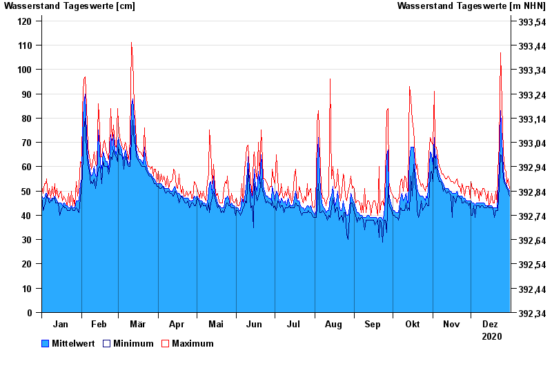
- Kötzting >
- Chart of year

Chart of year Kötzting / Weißer Regen
Waterlevel from 01.01.2020 to 31.12.2020
- 21.07.2011 Wasserstand: 234 cm
- 02.06.2013 Wasserstand: 231 cm
- 03.06.2010 Wasserstand: 221 cm
- 18.04.2009 Wasserstand: 211 cm
- 14.01.2011 Wasserstand: 203 cm
| Date | Mean value [cm] | Maximum [cm] | Minimum [cm] |
|---|---|---|---|
| 31.12.2020 | 50 | 51 | 48 |
| 30.12.2020 | 51 | 55 | 50 |
| 29.12.2020 | 52 | 53 | 51 |
| 28.12.2020 | 53 | 58 | 52 |
| 27.12.2020 | 54 | 59 | 53 |
| 26.12.2020 | 59 | 66 | 55 |
| 25.12.2020 | 71 | 86 | 64 |
© Bayerisches Landesamt für Umwelt 2025