
- Start >
- Rivers >
- Waterlevel >
- Bayern >
- Landau >
- Chart of month

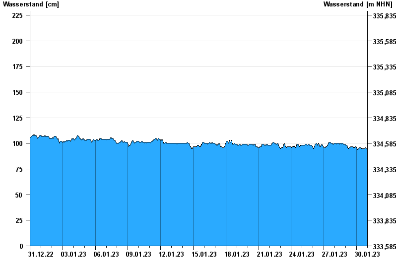
Chart of month Landau / Isar
Waterlevel from 31.12.2022 to 30.01.2023
- 04.06.2013 Wasserstand: 495 cm
- 19.06.1979 Wasserstand: 485 cm
- 24.05.1999 Wasserstand: 467 cm
- 25.08.2005 Wasserstand: 462 cm
- 23.07.1981 Wasserstand: 411 cm
| Date | Waterlevel [cm] |
|---|---|
| 30.01.2023 23:45 | 94 |
| 30.01.2023 23:30 | 94 |
| 30.01.2023 23:15 | 94 |
| 30.01.2023 23:00 | 94 |
| 30.01.2023 22:45 | 94 |
| 30.01.2023 22:30 | 94 |
| 30.01.2023 22:15 | 94 |
© Bayerisches Landesamt für Umwelt 2024