
- Start >
- Rivers >
- Waterlevel >
- Bayern >
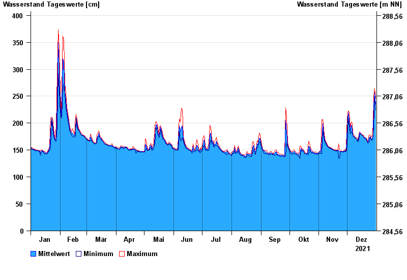
- Mainleus >
- Chart of year

Chart of year Mainleus / Main
Waterlevel from 01.01.2021 to 31.12.2021
- 26.01.1995 Wasserstand: 442 cm
- 13.02.2005 Wasserstand: 421 cm
- 14.01.2011 Wasserstand: 418 cm
- 21.12.1993 Wasserstand: 414 cm
- 28.05.2006 Wasserstand: 412 cm
| Date | Mean value [cm] | Maximum [cm] | Minimum [cm] |
|---|---|---|---|
| 31.12.2021 | 235 | 247 | 224 |
| 30.12.2021 | 257 | 265 | 247 |
| 29.12.2021 | 232 | 249 | 197 |
| 28.12.2021 | 180 | 197 | 176 |
| 27.12.2021 | 170 | 177 | 168 |
| 26.12.2021 | 171 | 174 | 169 |
| 25.12.2021 | 175 | 178 | 174 |
© Bayerisches Landesamt für Umwelt 2025