
- Start >
- Rivers >
- Waterlevel >
- Bayern >
- Reit im Winkl >
- Chart of month

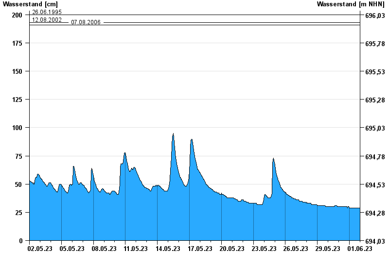
Chart of month Reit im Winkl / Schwarzlofer
Waterlevel from 02.05.2023 to 01.06.2023
- 02.06.2013 Wasserstand: 220 cm
- 08.08.1991 Wasserstand: 204 cm
- 26.06.1995 Wasserstand: 200 cm
- 12.08.2002 Wasserstand: 193 cm
- 07.08.2006 Wasserstand: 191 cm
| Date | Waterlevel [cm] |
|---|---|
| 02.06.2023 00:45 | 29 |
| 02.06.2023 00:30 | 29 |
| 02.06.2023 00:15 | 29 |
| 02.06.2023 00:00 | 29 |
| 01.06.2023 23:45 | 29 |
| 01.06.2023 23:30 | 29 |
| 01.06.2023 23:15 | 29 |
© Bayerisches Landesamt für Umwelt 2024