
- Start >
- Rivers >
- Waterlevel >
- Bayern >
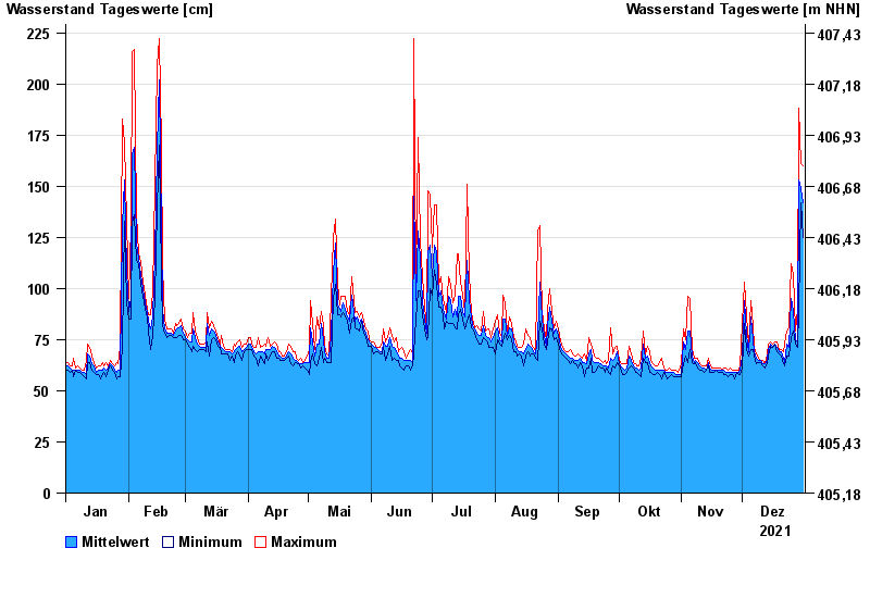
- Sägmühle >
- Chart of year

Chart of year Sägmühle / Schwarzer Regen
Waterlevel from 01.01.2021 to 31.12.2021
- 07.01.1993 Wasserstand: 393 cm
- 13.08.2002 Wasserstand: 385 cm
- 21.12.1993 Wasserstand: 326 cm
- 21.03.2002 Wasserstand: 312 cm
- 22.07.1980 Wasserstand: 306 cm
| Date | Mean value [cm] | Maximum [cm] | Minimum [cm] |
|---|---|---|---|
| 31.12.2021 | 142 | 160 | 125 |
| 30.12.2021 | 149 | 161 | 142 |
| 29.12.2021 | 153 | 188 | 90 |
| 28.12.2021 | 74 | 90 | 71 |
| 27.12.2021 | 75 | 79 | 73 |
| 26.12.2021 | 89 | 107 | 79 |
| 25.12.2021 | 95 | 112 | 76 |
© Bayerisches Landesamt für Umwelt 2024