
- Start >
- Rivers >
- Waterlevel >
- Bayern >
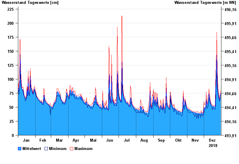
- Stein bei Altenmarkt >
- Chart of year

Chart of year Stein bei Altenmarkt / Traun
Waterlevel from 01.01.2018 to 31.12.2018
- 12.08.2002 Wasserstand: 367 cm
- 02.06.2013 Wasserstand: 347 cm
- 26.06.1995 Wasserstand: 330 cm
- 01.08.1977 Wasserstand: 329 cm
- 20.07.1981 Wasserstand: 328 cm
| Date | Mean value [cm] | Maximum [cm] | Minimum [cm] |
|---|---|---|---|
| 31.12.2018 | 75 | 79 | 72 |
| 30.12.2018 | 66 | 74 | 61 |
| 29.12.2018 | 63 | 65 | 61 |
| 28.12.2018 | 66 | 69 | 64 |
| 27.12.2018 | 70 | 74 | 68 |
| 26.12.2018 | 78 | 85 | 74 |
| 25.12.2018 | 97 | 117 | 85 |
© Bayerisches Landesamt für Umwelt 2025