
- Start >
- Rivers >
- Waterlevel >
- Bayern >
- Trauchgau >
- Chart of month

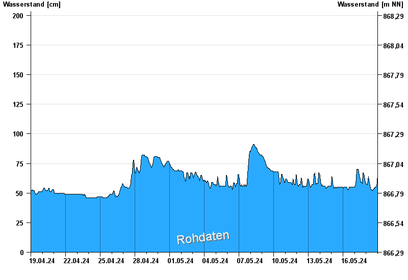
Chart of month Trauchgau / Halblech
Waterlevel from 19.04.2024 to 18.05.2024
- 23.08.2005 Wasserstand: 273 cm
- 22.05.1999 Wasserstand: 258 cm
- 22.06.2006 Wasserstand: 209 cm
- 01.06.2013 Wasserstand: 205 cm
- 03.06.2010 Wasserstand: 201 cm
| Date | Waterlevel [cm] |
|---|---|
| 19.05.2024 00:45 | 81 |
| 19.05.2024 00:30 | 79 |
| 19.05.2024 00:15 | 74 |
| 19.05.2024 00:00 | 69 |
| 18.05.2024 23:45 | 65 |
| 18.05.2024 23:30 | 62 |
| 18.05.2024 23:15 | 58 |
© Bayerisches Landesamt für Umwelt 2024