
- Start >
- Rivers >
- Waterlevel >
- Bayern >
- Unterlangenstadt >
- Chart of month

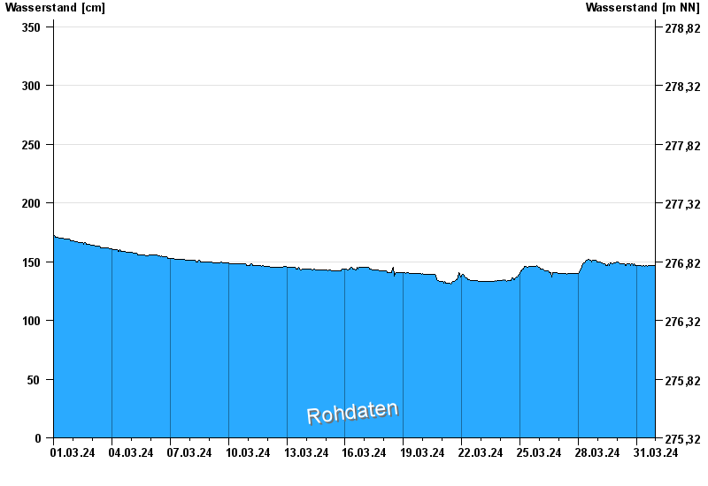
Chart of month Unterlangenstadt / Rodach
Waterlevel from 01.03.2024 to 31.03.2024
- 28.01.1901 Wasserstand: 522 cm
- 02.03.1901 Wasserstand: 490 cm
- 24.12.1967 Wasserstand: 482 cm
- 06.04.1901 Wasserstand: 482 cm
- 09.02.1946 Wasserstand: 477 cm
| Date | Waterlevel [cm] |
|---|---|
| 01.04.2024 00:45 | 146 |
| 01.04.2024 00:30 | 146 |
| 01.04.2024 00:15 | 146 |
| 01.04.2024 00:00 | 146 |
| 31.03.2024 23:45 | 146 |
| 31.03.2024 23:30 | 146 |
| 31.03.2024 23:15 | 147 |
© Bayerisches Landesamt für Umwelt 2024