
- Start >
- Rivers >
- Waterlevel >
- Bayern >
- Zwiesel >
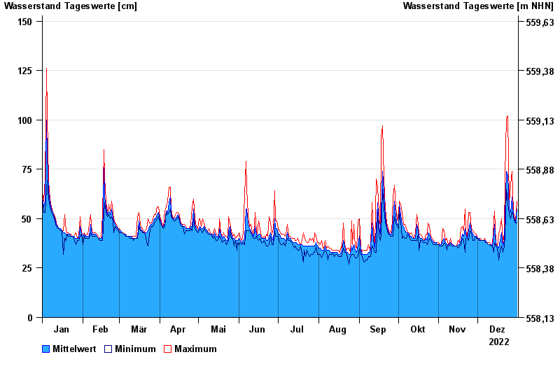
- Chart of year

Chart of year Zwiesel / Großer Regen
Waterlevel from 01.01.2022 to 31.12.2022
- 13.08.2002 Wasserstand: 207 cm
- 21.12.1993 Wasserstand: 196 cm
- 21.03.2002 Wasserstand: 186 cm
- 02.08.1991 Wasserstand: 186 cm
- 08.02.1946 Wasserstand: 178 cm
| Date | Mean value [cm] | Maximum [cm] | Minimum [cm] |
|---|---|---|---|
| 31.12.2022 | 55 | 59 | 48 |
| 30.12.2022 | 48 | 49 | 48 |
| 29.12.2022 | 50 | 51 | 49 |
| 28.12.2022 | 52 | 54 | 51 |
| 27.12.2022 | 61 | 74 | 54 |
| 26.12.2022 | 53 | 67 | 50 |
| 25.12.2022 | 55 | 58 | 52 |
© Bayerisches Landesamt für Umwelt 2025