
- Start >
- Rivers >
- Waterlevel >
- Oberer Main - Elbe >
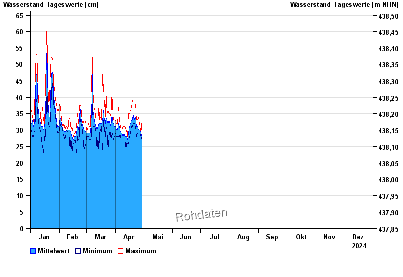
- Achsheim >
- Chart of year

Chart of year Achsheim / Schmutter
Waterlevel from 01.01.2024 to 31.12.2024
- 23.08.2005 Wasserstand: 162 cm
- 14.04.1994 Wasserstand: 142 cm
- 22.09.2000 Wasserstand: 139 cm
- 12.08.2002 Wasserstand: 137 cm
- 08.06.2002 Wasserstand: 137 cm
| Date | Mean value [cm] | Maximum [cm] | Minimum [cm] |
|---|---|---|---|
| 18.09.2024 | 68 | 70 | 66 |
| 17.09.2024 | 65 | 67 | 63 |
| 16.09.2024 | 52 | 64 | 39 |
| 15.09.2024 | 50 | 54 | 40 |
| 14.09.2024 | 45 | 55 | 34 |
| 13.09.2024 | 39 | 45 | 33 |
| 12.09.2024 | 32 | 36 | 29 |
© Bayerisches Landesamt für Umwelt 2024