
- Start >
- Rivers >
- Waterlevel >
- Oberer Main - Elbe >
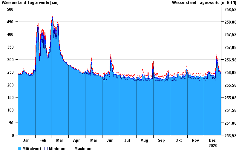
- Laufermühle >
- Chart of year

Chart of year Laufermühle / Aisch
Waterlevel from 01.01.2020 to 31.12.2020
- 10.07.2021 Wasserstand: 609 cm
- 01.06.2013 Wasserstand: 584 cm
- 26.01.1995 Wasserstand: 563 cm
- 09.01.2011 Wasserstand: 553 cm
- 30.10.1998 Wasserstand: 548 cm
| Date | Mean value [cm] | Maximum [cm] | Minimum [cm] |
|---|---|---|---|
| 31.12.2020 | 247 | 251 | 245 |
| 30.12.2020 | 252 | 256 | 251 |
| 29.12.2020 | 254 | 259 | 251 |
| 28.12.2020 | 251 | 253 | 249 |
| 27.12.2020 | 263 | 271 | 253 |
| 26.12.2020 | 279 | 290 | 271 |
| 25.12.2020 | 294 | 300 | 290 |
© Bayerisches Landesamt für Umwelt 2025