
- Start >
- Rivers >
- Waterlevel >
- Oberer Main - Elbe >
- Leucherhof >
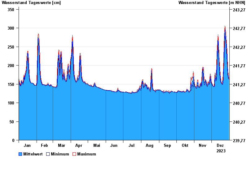
- Chart of year

Chart of year Leucherhof / Baunach
Waterlevel from 01.01.2023 to 31.12.2023
- 07.05.1969 Wasserstand: 391 cm
- 23.02.1970 Wasserstand: 378 cm
- 03.01.2003 Wasserstand: 369 cm
- 08.01.2011 Wasserstand: 367 cm
- 23.01.1995 Wasserstand: 366 cm
| Date | Mean value [cm] | Maximum [cm] | Minimum [cm] |
|---|---|---|---|
| 31.12.2023 | 163 | 165 | 162 |
| 30.12.2023 | 170 | 175 | 165 |
| 29.12.2023 | 183 | 196 | 175 |
| 28.12.2023 | 208 | 223 | 196 |
| 27.12.2023 | 238 | 253 | 223 |
| 26.12.2023 | 264 | 273 | 253 |
| 25.12.2023 | 285 | 296 | 273 |
© Bayerisches Landesamt für Umwelt 2025