
- Start >
- Rivers >
- Waterlevel >
- Oberer Main - Elbe >
- Marktleuthen >
- Current values

Current values Marktleuthen / Eger
Waterlevel from 15.02.2025 to 21.02.2025
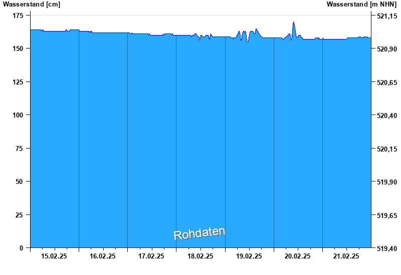
- Hochwassergefahrenfläche HQhäufig 330 cm
| Date | Waterlevel [cm] |
|---|---|
| 21.02.2025 23:45 | 158 |
| 21.02.2025 23:30 | 158 |
| 21.02.2025 23:15 | 158 |
| 21.02.2025 23:00 | 158 |
| 21.02.2025 22:45 | 158 |
| 21.02.2025 22:30 | 158 |
| 21.02.2025 22:15 | 158 |
© Bayerisches Landesamt für Umwelt 2025