
- Start >
- Rivers >
- Waterlevel >
- Oberer Main - Elbe >
- Pottenstein >
- Chart of year

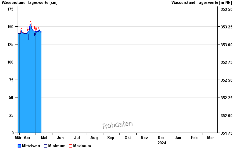
Chart of year Pottenstein / Püttlach
Waterlevel from 29.03.2024 to 28.03.2025
 Für diesen Pegel sind keine Meldestufen hinterlegt.
note
Abfluss durch starke Verkrautung behindert; Abflusswerte unsicher
| Date | Mean value [cm] | Maximum [cm] | Minimum [cm] |
|---|---|---|---|
| 09.08.2024 | 161 | 161 | 161 |
| 08.08.2024 | 161 | 162 | 160 |
| 07.08.2024 | 161 | 163 | 160 |
| 06.08.2024 | 161 | 167 | 151 |
| 05.08.2024 | 161 | 161 | 160 |
| 04.08.2024 | 161 | 162 | 160 |
| 03.08.2024 | 161 | 162 | 160 |
© Bayerisches Landesamt für Umwelt 2024