
- Start >
- Rivers >
- Waterlevel >
- Oberer Main - Elbe >
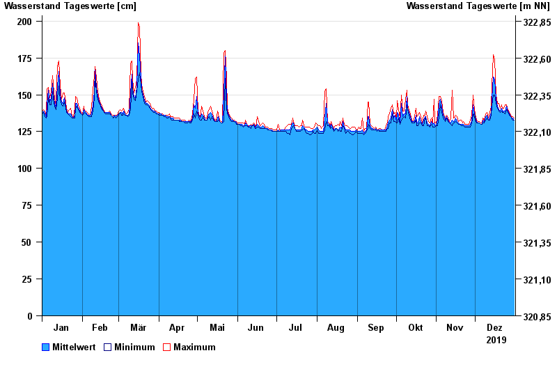
- Trebgast >
- Chart of year

Chart of year Trebgast / Trebgast
Waterlevel from 01.01.2019 to 31.12.2019
- 01.04.1988 Wasserstand: 323 cm
- 08.01.2011 Wasserstand: 317 cm
- 08.06.2002 Wasserstand: 303 cm
- 26.01.1995 Wasserstand: 303 cm
- 23.02.1970 Wasserstand: 300 cm
| Date | Mean value [cm] | Maximum [cm] | Minimum [cm] |
|---|---|---|---|
| 31.12.2019 | 133 | 134 | 133 |
| 30.12.2019 | 134 | 135 | 133 |
| 29.12.2019 | 134 | 135 | 134 |
| 28.12.2019 | 135 | 136 | 135 |
| 27.12.2019 | 137 | 138 | 136 |
| 26.12.2019 | 139 | 140 | 138 |
| 25.12.2019 | 142 | 143 | 140 |
© Bayerisches Landesamt für Umwelt 2025