
- Start >
- Rivers >
- Waterlevel >
- Oberer Main - Elbe >
- Unterhammer >
- Chart of month

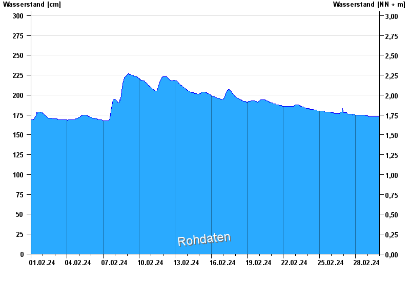
Chart of month Unterhammer / Südliche Regnitz
Waterlevel from 01.02.2024 to 29.02.2024
note
z.T. schlechte Netzanbindung
| Date | Waterlevel [cm] |
|---|---|
| 29.02.2024 23:45 | 172 |
| 29.02.2024 23:30 | 173 |
| 29.02.2024 23:15 | 173 |
| 29.02.2024 23:00 | 173 |
| 29.02.2024 22:45 | 173 |
| 29.02.2024 22:30 | 173 |
| 29.02.2024 22:15 | 173 |
© Bayerisches Landesamt für Umwelt 2025