
- Start >
- Rivers >
- Waterlevel >
- Iller - Lech - Bodensee >
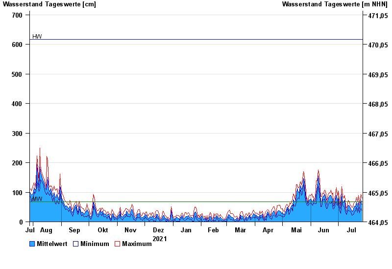
- Oberaudorf >
- Chart of year

Chart of year Oberaudorf / Inn
Waterlevel from 28.07.2021 to 27.07.2022
| Date | Mean value [cm] | Maximum [cm] | Minimum [cm] |
|---|---|---|---|
| 27.07.2022 | 58 | 79 | 38 |
| 26.07.2022 | 74 | 92 | 46 |
| 25.07.2022 | 53 | 67 | 37 |
| 24.07.2022 | 44 | 60 | 29 |
| 23.07.2022 | 67 | 90 | 49 |
| 22.07.2022 | 51 | 68 | 31 |
| 21.07.2022 | 66 | 82 | 50 |
© Bayerisches Landesamt für Umwelt 2024