
- Start >
- Rivers >
- Waterlevel >
- Iller - Lech - Bodensee >
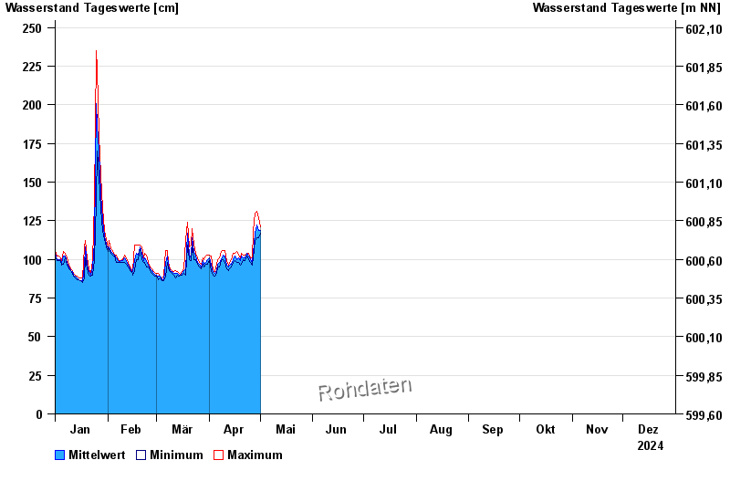
- Schlehdorf >
- Chart of year

Chart of year Schlehdorf / Loisach
Waterlevel from 01.01.2024 to 31.12.2024
- 22.05.1999 Wasserstand: 489 cm
- 23.08.2005 Wasserstand: 467 cm
- 03.06.2013 Wasserstand: 419 cm
- 05.08.2020 Wasserstand: 357 cm
- 19.07.2021 Wasserstand: 349 cm
| Date | Mean value [cm] | Maximum [cm] | Minimum [cm] |
|---|---|---|---|
| 13.09.2024 | 134 | 168 | 113 |
| 12.09.2024 | 114 | 120 | 104 |
| 11.09.2024 | 110 | 121 | 103 |
| 10.09.2024 | 115 | 129 | 100 |
| 09.09.2024 | 103 | 111 | 89 |
| 08.09.2024 | 87 | 90 | 86 |
| 07.09.2024 | 88 | 89 | 87 |
© Bayerisches Landesamt für Umwelt 2024