
- Start >
- Rivers >
- Waterlevel >
- Iller - Lech - Bodensee >
- Schlehdorf >
- Chart of year

Chart of year Schlehdorf / Loisach
Waterlevel from 23.05.2022 to 22.05.2023
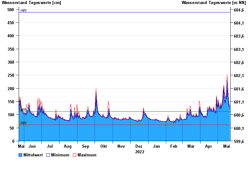
| Date | Mean value [cm] | Maximum [cm] | Minimum [cm] |
|---|---|---|---|
| 22.05.2023 | 130 | 134 | 119 |
| 21.05.2023 | 135 | 139 | 126 |
| 20.05.2023 | 145 | 153 | 139 |
| 19.05.2023 | 162 | 175 | 153 |
| 18.05.2023 | 191 | 216 | 175 |
| 17.05.2023 | 230 | 253 | 194 |
| 16.05.2023 | 166 | 194 | 158 |
© Bayerisches Landesamt für Umwelt 2025