
- Start >
- Rivers >
- Waterlevel >
- Isar >
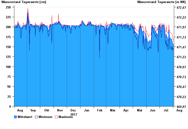
- Bad Aibling >
- Chart of year

Chart of year Bad Aibling / Triftbach linker Mühlkanal
Waterlevel from 03.08.2017 to 02.08.2018
- 02.06.2013 Wasserstand: 332 cm
- 10.08.1970 Wasserstand: 280 cm
- 22.05.1999 Wasserstand: 275 cm
- 18.06.1979 Wasserstand: 270 cm
- 20.07.1981 Wasserstand: 261 cm
| Date | Mean value [cm] | Maximum [cm] | Minimum [cm] |
|---|---|---|---|
| 02.08.2018 | 156 | 170 | 142 |
| 01.08.2018 | 155 | 167 | 146 |
| 31.07.2018 | 158 | 170 | 143 |
| 30.07.2018 | 161 | 179 | 150 |
| 29.07.2018 | 166 | 183 | 142 |
| 28.07.2018 | 170 | 184 | 151 |
| 27.07.2018 | 168 | 184 | 150 |
© Bayerisches Landesamt für Umwelt 2024