
- Start >
- Rivers >
- Waterlevel >
- Isar >
- Eschelbach >
- Chart of year

Chart of year Eschelbach / Inn
Waterlevel from 28.04.2024 to 27.04.2025
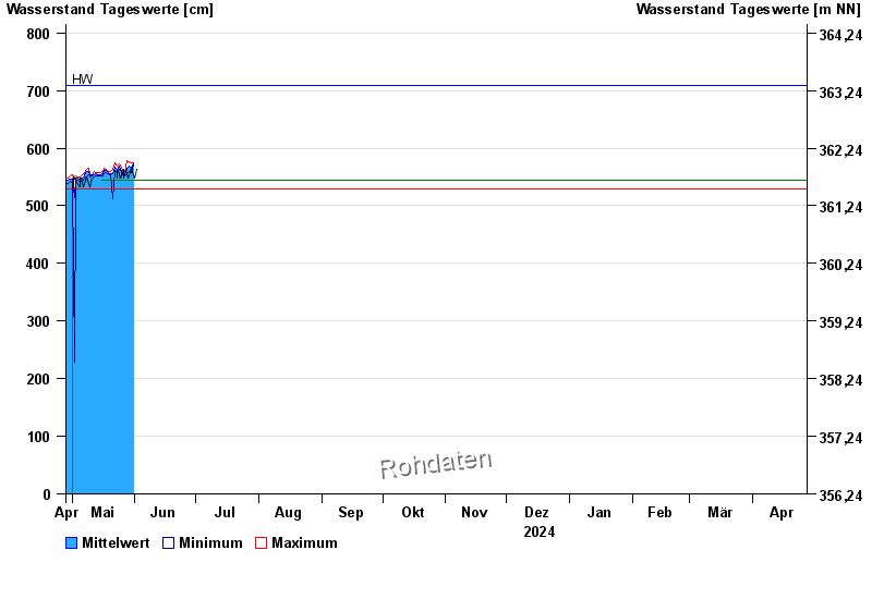
| Date | Mean value [cm] | Maximum [cm] | Minimum [cm] |
|---|---|---|---|
| 14.09.2024 | 556 | 557 | 554 |
| 13.09.2024 | 551 | 555 | 548 |
| 12.09.2024 | 551 | 555 | 545 |
| 11.09.2024 | 547 | 552 | 541 |
| 10.09.2024 | 556 | 564 | 548 |
| 09.09.2024 | 553 | 569 | 541 |
| 08.09.2024 | 542 | 546 | 539 |
© Bayerisches Landesamt für Umwelt 2024