
- Start >
- Rivers >
- Waterlevel >
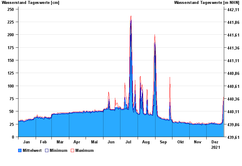
- Isar >
- Freising >
- Chart of year

Chart of year Freising / Isar
Waterlevel from 01.01.2021 to 31.12.2021
- 24.08.2005 Wasserstand: 452 cm
- 23.05.1999 Wasserstand: 388 cm
- 03.06.2013 Wasserstand: 387 cm
- 20.07.1981 Wasserstand: 379 cm
- 05.08.2020 Wasserstand: 336 cm
Date | Mean value [cm] | Maximum [cm] | Minimum [cm] |
|---|---|---|---|
| 31.12.2021 | 70 | 78 | 34 |
| 30.12.2021 | 36 | 58 | 29 |
| 29.12.2021 | 28 | 30 | 27 |
| 28.12.2021 | 27 | 28 | 26 |
| 27.12.2021 | 26 | 27 | 25 |
| 26.12.2021 | 26 | 27 | 25 |
| 25.12.2021 | 25 | 26 | 24 |
© Bayerisches Landesamt für Umwelt 2025