
- Start >
- Rivers >
- Waterlevel >
- Obere Donau >
- Lentersdorf >
- Chart of month

Chart of month Lentersdorf / Bibert
Waterlevel from 26.04.2022 to 25.05.2022
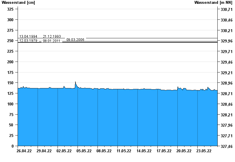
- 13.04.1994 Wasserstand: 256 cm
- 21.12.1993 Wasserstand: 256 cm
- 09.03.2006 Wasserstand: 248 cm
- 12.03.1979 Wasserstand: 246 cm
- 08.01.2011 Wasserstand: 245 cm
| Date | Waterlevel [cm] |
|---|---|
| 26.05.2022 00:45 | 132 |
| 26.05.2022 00:30 | 132 |
| 26.05.2022 00:15 | 132 |
| 26.05.2022 00:00 | 132 |
| 25.05.2022 23:45 | 132 |
| 25.05.2022 23:30 | 132 |
| 25.05.2022 23:15 | 132 |
© Bayerisches Landesamt für Umwelt 2024