
- Start >
- Rivers >
- Waterlevel >
- Obere Donau >
- Mühlstetten >
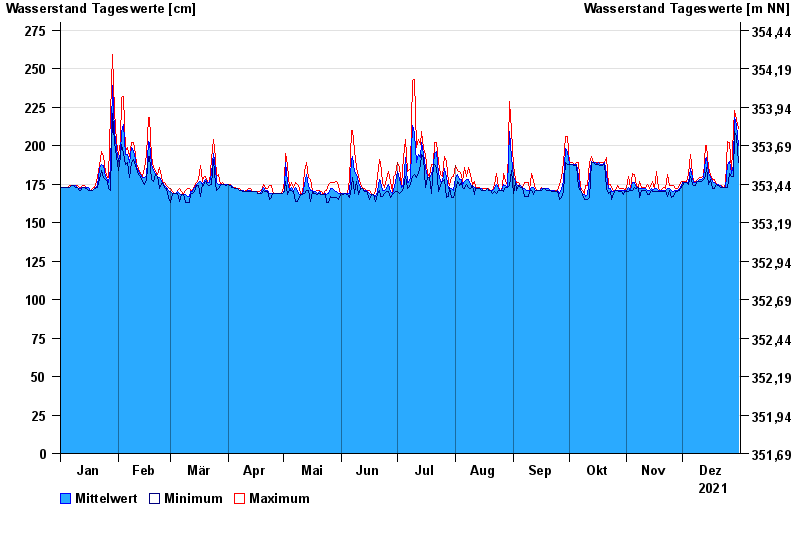
- Chart of year

Chart of year Mühlstetten / Schwäbische Rezat
Waterlevel from 01.01.2021 to 31.12.2021
- 02.03.1987 Wasserstand: 379 cm
- 09.05.1978 Wasserstand: 374 cm
- 13.04.1994 Wasserstand: 369 cm
- 29.05.1985 Wasserstand: 367 cm
- 31.01.1982 Wasserstand: 364 cm
| Date | Mean value [cm] | Maximum [cm] | Minimum [cm] |
|---|---|---|---|
| 31.12.2021 | 200 | 211 | 189 |
| 30.12.2021 | 213 | 217 | 206 |
| 29.12.2021 | 218 | 223 | 209 |
| 28.12.2021 | 187 | 210 | 180 |
| 27.12.2021 | 182 | 184 | 180 |
| 26.12.2021 | 190 | 202 | 182 |
| 25.12.2021 | 188 | 203 | 173 |
© Bayerisches Landesamt für Umwelt 2025