
- Start >
- Rivers >
- Waterlevel >
- Obere Donau >
- Roth >
- Chart of month

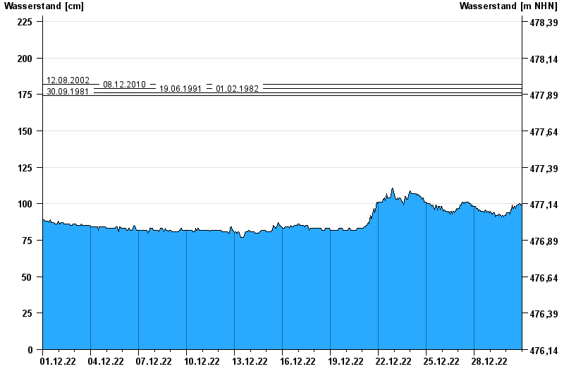
Chart of month Roth / Roth
Waterlevel from 01.12.2022 to 30.12.2022
- 02.06.2024 Wasserstand: 201 cm
- 12.08.2002 Wasserstand: 182 cm
- 08.12.2010 Wasserstand: 179 cm
- 19.06.1991 Wasserstand: 176 cm
- 01.02.1982 Wasserstand: 176 cm
| Date | Waterlevel [cm] |
|---|---|
| 30.12.2022 23:45 | 99 |
| 30.12.2022 23:30 | 99 |
| 30.12.2022 23:15 | 99 |
| 30.12.2022 23:00 | 99 |
| 30.12.2022 22:45 | 99 |
| 30.12.2022 22:30 | 99 |
| 30.12.2022 22:15 | 99 |
© Bayerisches Landesamt für Umwelt 2025