
- Start >
- Rivers >
- Waterlevel >
- Obere Donau >
- Thann >
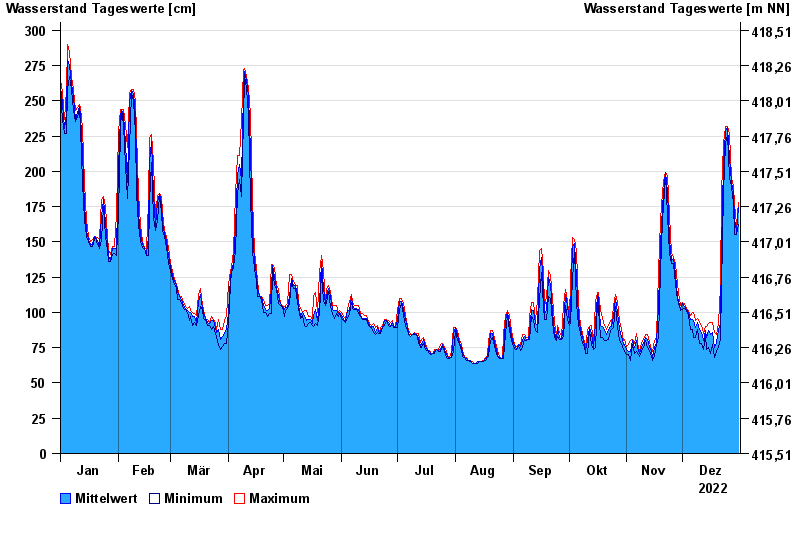
- Chart of year

Chart of year Thann / Altmühl
Waterlevel from 01.01.2022 to 31.12.2022
- 01.06.2013 Wasserstand: 335 cm
- 29.10.1998 Wasserstand: 327 cm
- 21.12.1993 Wasserstand: 324 cm
- 08.01.2011 Wasserstand: 323 cm
- 17.06.2007 Wasserstand: 320 cm
| Date | Mean value [cm] | Maximum [cm] | Minimum [cm] |
|---|---|---|---|
| 31.12.2022 | 174 | 178 | 162 |
| 30.12.2022 | 157 | 162 | 155 |
| 29.12.2022 | 166 | 177 | 155 |
| 28.12.2022 | 185 | 189 | 177 |
| 27.12.2022 | 192 | 195 | 189 |
| 26.12.2022 | 210 | 226 | 195 |
| 25.12.2022 | 231 | 232 | 226 |
© Bayerisches Landesamt für Umwelt 2025