
- Start >
- Rivers >
- Waterlevel >
- Obere Donau >
- Weinzierlein >
- Chart of year

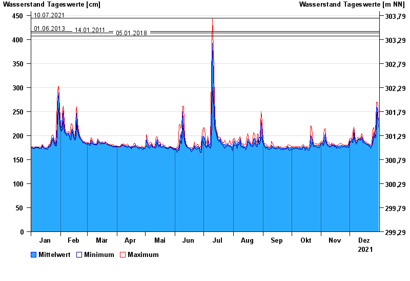
Chart of year Weinzierlein / Bibert
Waterlevel from 01.01.2021 to 31.12.2021
- 08.01.2011 Wasserstand: 459 cm
- 10.07.2021 Wasserstand: 444 cm
- 01.06.2013 Wasserstand: 417 cm
- 14.01.2011 Wasserstand: 414 cm
- 05.01.2018 Wasserstand: 407 cm
| Date | Mean value [cm] | Maximum [cm] | Minimum [cm] |
|---|---|---|---|
| 31.12.2021 | 232 | 249 | 217 |
| 30.12.2021 | 255 | 269 | 249 |
| 29.12.2021 | 260 | 270 | 229 |
| 28.12.2021 | 204 | 229 | 196 |
| 27.12.2021 | 198 | 199 | 196 |
| 26.12.2021 | 207 | 217 | 199 |
| 25.12.2021 | 195 | 214 | 184 |
© Bayerisches Landesamt für Umwelt 2025