
- Start >
- Rivers >
- Waterlevel >
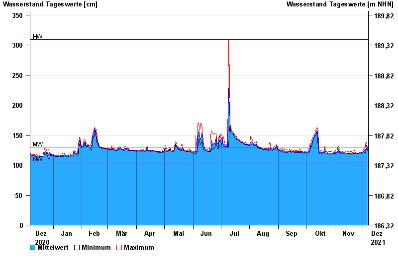
- Unterer Main >
- Marktbreit >
- Chart of year

Chart of year Marktbreit / Breitbach
Waterlevel from 07.12.2020 to 06.12.2021
note
1. Geber ist ausgefallen. Datenlücken sind möglich.
| Date | Mean value [cm] | Maximum [cm] | Minimum [cm] |
|---|---|---|---|
| 06.12.2021 | 126 | 128 | 124 |
| 05.12.2021 | 133 | 138 | 128 |
| 04.12.2021 | 125 | 135 | 121 |
| 03.12.2021 | 124 | 126 | 122 |
| 02.12.2021 | 124 | 128 | 120 |
| 01.12.2021 | 121 | 123 | 120 |
| 30.11.2021 | 121 | 122 | 119 |
© Bayerisches Landesamt für Umwelt 2024