
- Start >
- Rivers >
- Waterlevel >
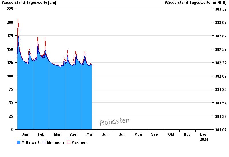
- Unterer Main >
- Unterweißenbrunn >
- Chart of year

Chart of year Unterweißenbrunn / Brend
Waterlevel from 01.01.2024 to 31.12.2024
| Date | Mean value [cm] | Maximum [cm] | Minimum [cm] |
|---|---|---|---|
| 23.12.2024 | 139 | 142 | 138 |
| 22.12.2024 | 145 | 149 | 142 |
| 21.12.2024 | 137 | 143 | 135 |
| 20.12.2024 | 143 | 153 | 137 |
| 19.12.2024 | 139 | 157 | 129 |
| 18.12.2024 | 131 | 133 | 129 |
| 17.12.2024 | 137 | 139 | 133 |
© Bayerisches Landesamt für Umwelt 2024