
- Start >
- Rivers >
- Waterlevel >
- Naab - Regen >
- Leming >
- Chart of year

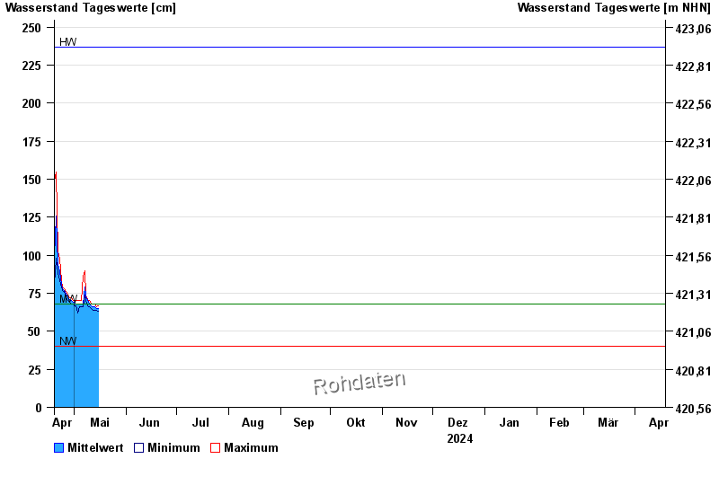
Chart of year Leming / Freybach
Waterlevel from 19.04.2024 to 18.04.2025
| Date | Mean value [cm] | Maximum [cm] | Minimum [cm] |
|---|---|---|---|
| 26.12.2024 | 80 | 81 | 80 |
| 25.12.2024 | 82 | 84 | 81 |
| 24.12.2024 | 86 | 89 | 84 |
| 23.12.2024 | 95 | 109 | 89 |
| 22.12.2024 | 119 | 157 | 80 |
| 21.12.2024 | 79 | 80 | 78 |
| 20.12.2024 | 82 | 84 | 80 |
© Bayerisches Landesamt für Umwelt 2024